
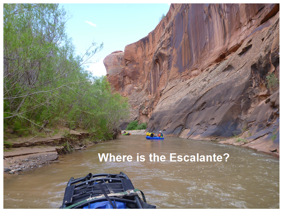
Floating the Escalante
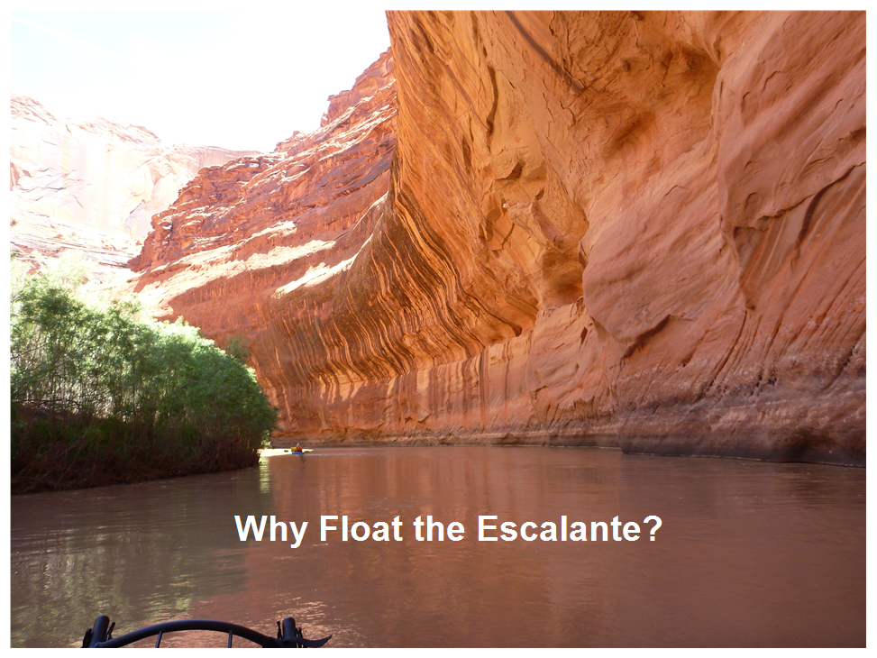
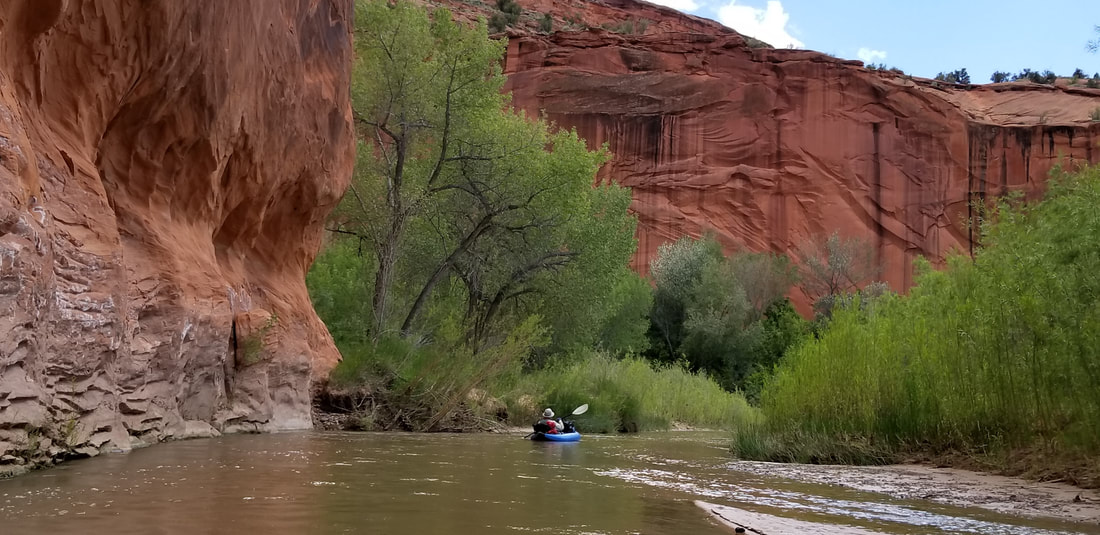
The Canyon of the Escalante is a beautiful place. The scenery is superb, with the smooth lines of multi-colored sandstone rising above the green of the box elder trees. By floating the Escalante, you can get away from the many hikers and rock climbers in the side canyons. Unlike the enormous canyons on the Green River and Colorado River, the Escalante is more intimate. You can get your mind around a smaller canyon. The dark red sandstone is Navajo Sandstone while the higher, lighter sandstone is Entrada Sandstone.
In the spring of 2019, four of us floated the Escalante River. It was our first trip on the Escalante, and we made some mistakes, but it is a great place and I highly recommend it to other boaters. It is different from the usual float, so you need to be prepared.
In the spring of 2019, four of us floated the Escalante River. It was our first trip on the Escalante, and we made some mistakes, but it is a great place and I highly recommend it to other boaters. It is different from the usual float, so you need to be prepared.
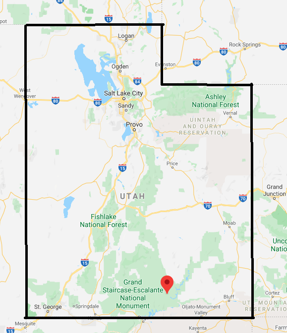
The Escalante River starts just west of Escalante, Utah and flows south to Lake Powell. It is only about 80-90 miles long. It was named after Silvestre Velez de Escalante, a Franciscan missionary. The Dominguez-Escalante expedition explored this area around 1776. They were the first Europeans in Utah and were headed for Monterey, California.
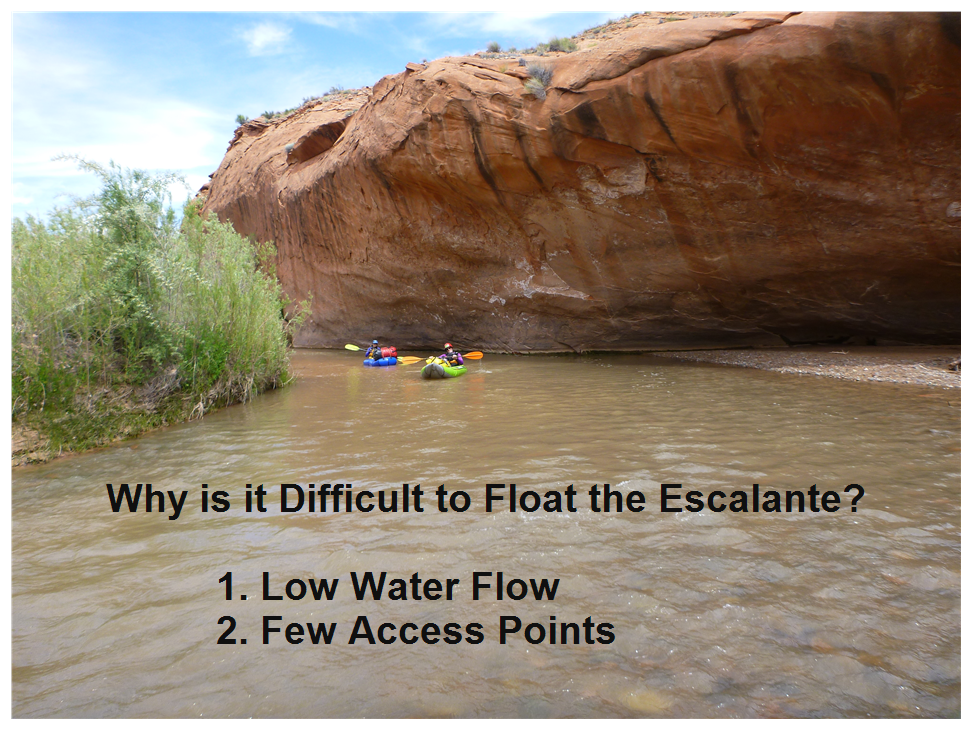
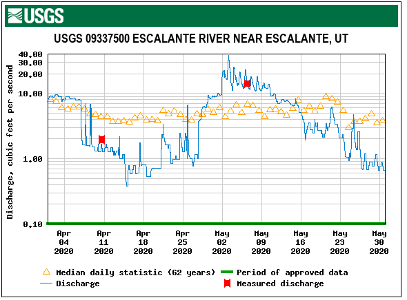
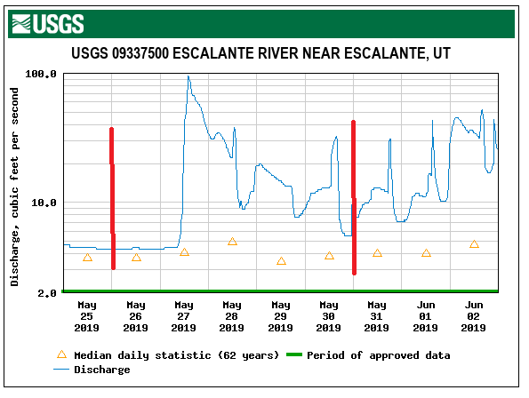
The graph above shows the flow in the Escalante River near Escalante, Utah for 2020. The peak was only about 40 cfs. This makes it difficult to start out at the Highway 12 Bridge if there is not enough water. The Highway 12 Bridge is the only put-in where you can drive your car close to the river. You can start further downstream, but these involve backpacking your boat and gear to the river.
The flow of water in the Escalante is highly variable. You need to have people ready to go when the flow goes up. This occurs when the snow starts melting, or after a rain. You need to monitor the snowpack in the mountains for good years. There are some streams running into the Escalante, so generally, there is more water as you go further south.
Link to water flow.
https://waterdata.usgs.gov/ut/nwis/uv?site_no=09337500
We floated from May 26 to May 30 in 2019. Luckily, there was good snow pack and it rained, so we had plenty of water. We also hiked in. We started at Fence Canyon about river mile 35, measuring from the Highway 12 Bridge as mile 0.
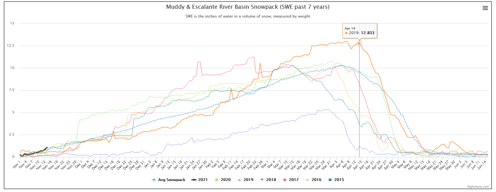
We floated in 2019, which was a good snow pack year. The previous 5 years had a lot less snow. This graph is available at this link:
http://snowpack.water-data.com/uppercolorado/index.php?allrb=6
http://snowpack.water-data.com/uppercolorado/index.php?allrb=6
On most river trips you can drive fairly close to the put-in and the take-out. So you can load a lot of gear into your boat. You never have to carry your gear very far. With the Escalante, there is only one place you can get your car near the river. It is 12 miles east of Escalante where Highway 12 crosses the river. This is the only put-in where you can drive close to the river.
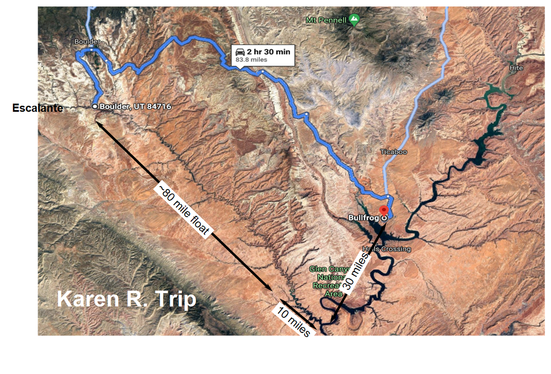
We are going to look at three ways to float the Escalante. The first is the Karen R. Trip shown above.
In this trip, you put-in at the Highway 12 Bridge, so you don't have to carry equipment very far. You run the shuttle to Bullfrog Marina, about 83 miles or 2.5 hours one way. You float some 80 miles until the river gets to Lake Powell. In Lake Powell, you are still around 40 miles from Bullfrog marina. You have to arrange to be picked up by a large boat when you get to Lake Powell or you paddle out. Lake Powell can have strong winds and high waves.
Concerns:
1. How many cfs you need to float at the put-in is debatable. Some say 100 cfs, others only 60 cfs. I don't know the answer.
2. How muddy is it when the Escalante reaches Lake Powell?
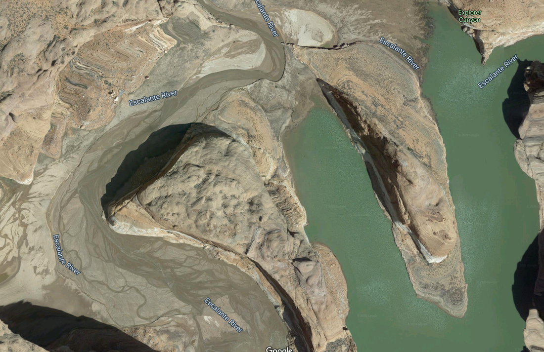
The above photo is a Google Satellite view of near where the Escalante meets Lake Powell. You may have to drag or carry your boat through the mud. The water on the right is not connected to Lake Powell. It is a oxbow lake.
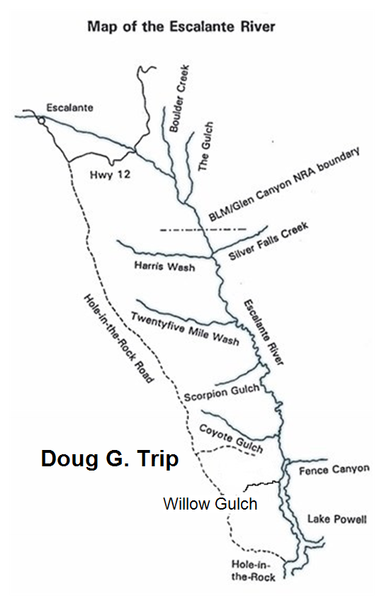
The drawing above shows the Doug G. trip. You start out with the put-in at the Highway 12 Bridge, but you run the shuttle down the Hole-In-The-Rock road and leave the cars at a parking lot near Willow Gulch. This road was constructed by a group of Mormons in 1879. They were headed for Bluff, UT and cut out a portion of the 1000 foot cliff above the Colorado River. The road crossed the Colorado River and headed towards Bluff. It is a dirt road, with some gravel in places. 4 wheel vehicles are recommended and the trail should be avoided when wet. The road is 62 miles long. After getting back to the bridge, you float the Escalante into Lake Powell and get out at Willow Gulch, so you do have to paddle in the lake a few miles. Lake Powell can have high waves and strong winds. This is where the trip gets interesting. You next hide your boats and equipment and hike out Willow Gulch to your cars. Then you drive to Bullfrog and rent a boat. You drive the boat you rented 40 miles in Lake Powell and take it up the Escalante Canyon branch of Lake Powell and pick up your boats and gear. The walk up Willow Gulch is less strenuous than doing crack-in-the-wall at Coyote Gulch.
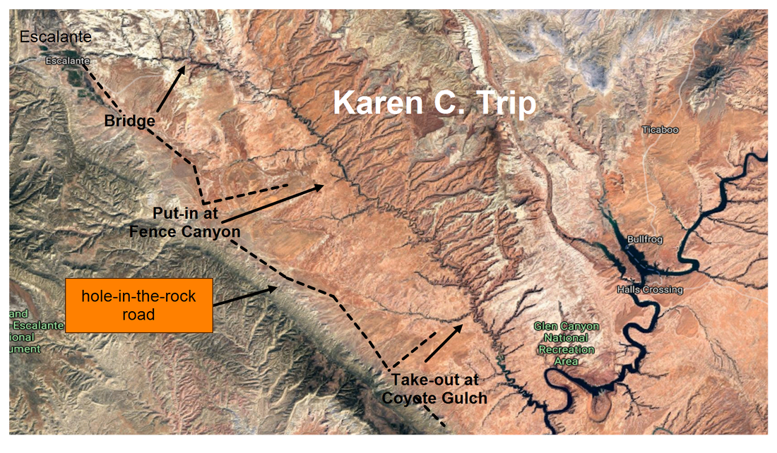
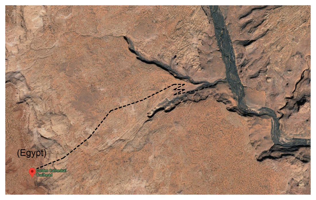
We took the Karen C. trip shown above. On this trip you drive to the Golden Cathedral (Egypt) Trailhead and hike 3.6 miles or so to the river. Then you return to drive the shuttle. The shuttle is 35 miles one way, so the 70 miles takes about 5 hours. Since you are further downstream than the Highway 12 Bridge, the river has more water in it. There are other places where you can access the river, but they all involve hiking your gear in. There are outfits in Escalante that will drop you off and pick you up for a fee. We just did the shuttle ourselves.
Day 1:
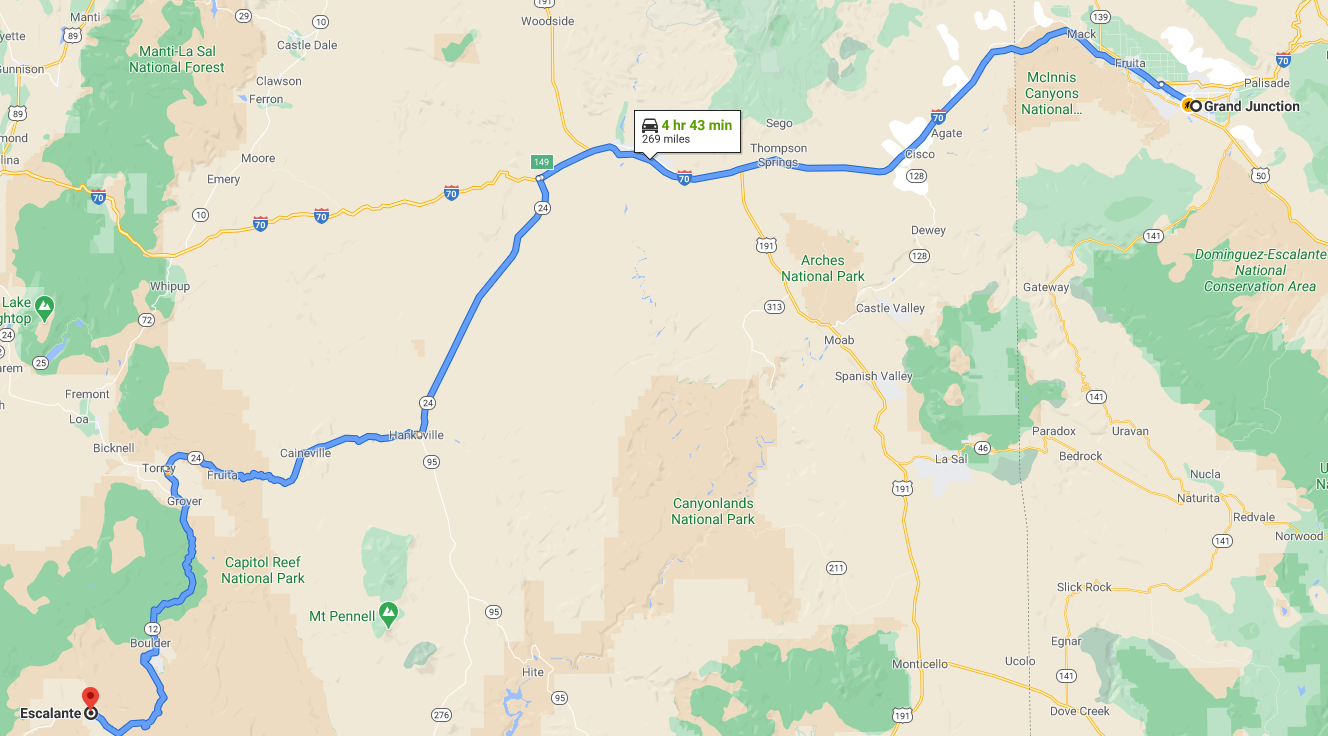
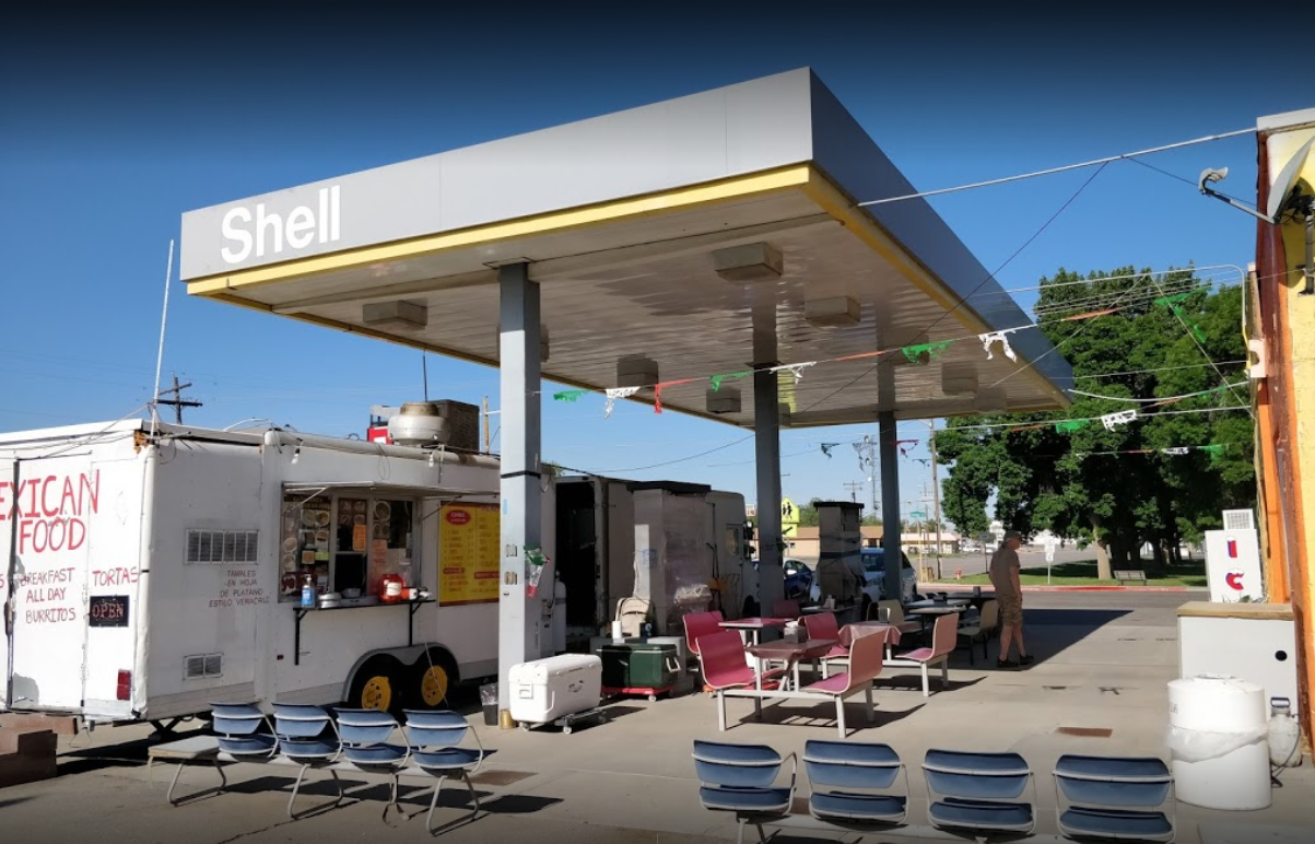
We drove from Northern Colorado to Escalante in one day. The road distance is 570 miles and Google says it takes about 9 hours. We ate at the "Tacos La Pasadita" food truck in Green River, UT. It's near the park. "Pasadita" means little pass. We stopped on our return trip also. Great Place!
We stayed at "Escalante Cabins and RV" right across the road from the Grand Staircase Escalante National Monument Visitor's Center. You should stop at the visitor's center to learn the latest road and river conditions. They warned us about a tree across the river just downstream from our put-in at Fence Canyon. "Escalante Cabins and RV" is a really nice place, highly recommended.
Day 2:
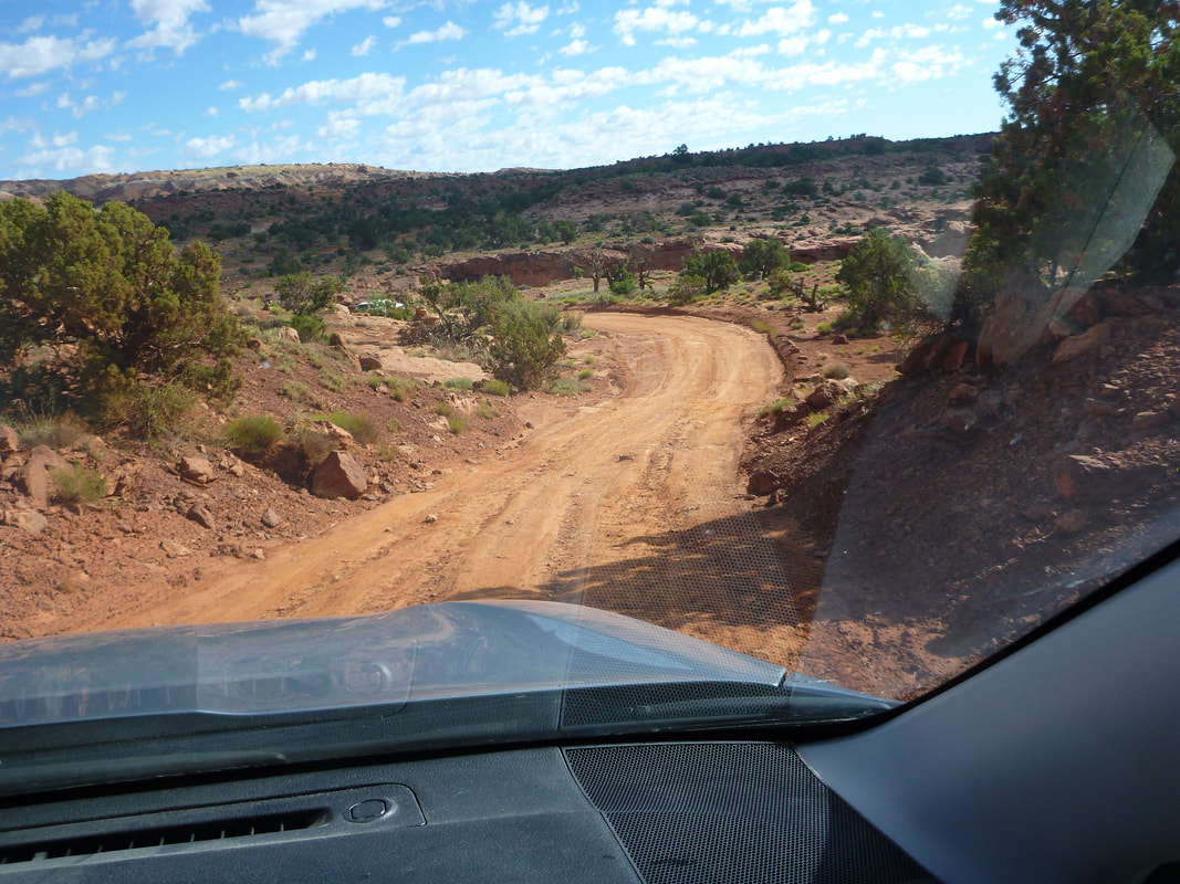
The next day was consumed by getting to the river and driving the shuttle. The roads are just dirt roads and are fine for 4-wheel drive vehicles. The roads should be avoided when wet.
We drove from Northern Colorado to Escalante in one day. The road distance is 570 miles and Google says it takes about 9 hours. We ate at the "Tacos La Pasadita" food truck in Green River, UT. It's near the park. "Pasadita" means little pass. We stopped on our return trip also. Great Place!
We stayed at "Escalante Cabins and RV" right across the road from the Grand Staircase Escalante National Monument Visitor's Center. You should stop at the visitor's center to learn the latest road and river conditions. They warned us about a tree across the river just downstream from our put-in at Fence Canyon. "Escalante Cabins and RV" is a really nice place, highly recommended.
Day 2:
The next day was consumed by getting to the river and driving the shuttle. The roads are just dirt roads and are fine for 4-wheel drive vehicles. The roads should be avoided when wet.
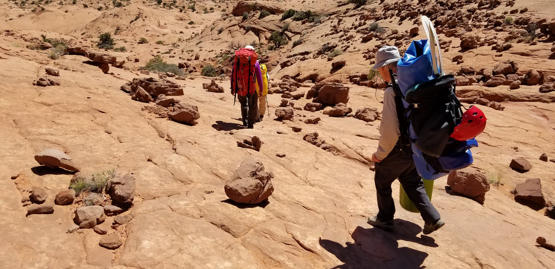
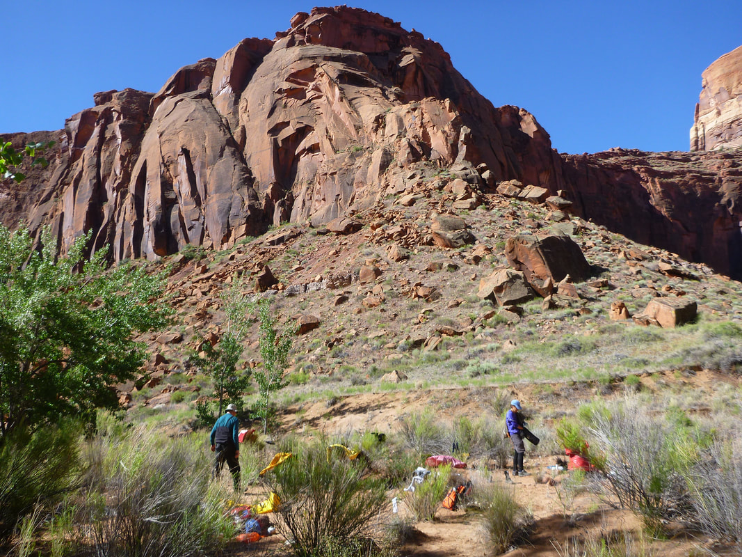
Our first problem was that we had too much equipment. We had to take two trips instead of one to get to the river. That doesn't double the mileage, it multiples by 3. If it is 3 miles to the river and you take two trips, you have to walk 9 miles. We were helped by a group that started at the bridge and decided to exit at Fence. The previous week had been very cold and they had suffered enough. They were taking multiple trips down to get their gear, and they offered to help us carry gear down, as they were headed that way anyway. Nice people!
In this picture I am just carrying my duckie, paddle, helmet, PFD, and a bag. So I still had another backup with tent, sleeping bag, food, etc. for the second trip.
In this picture I am just carrying my duckie, paddle, helmet, PFD, and a bag. So I still had another backup with tent, sleeping bag, food, etc. for the second trip.
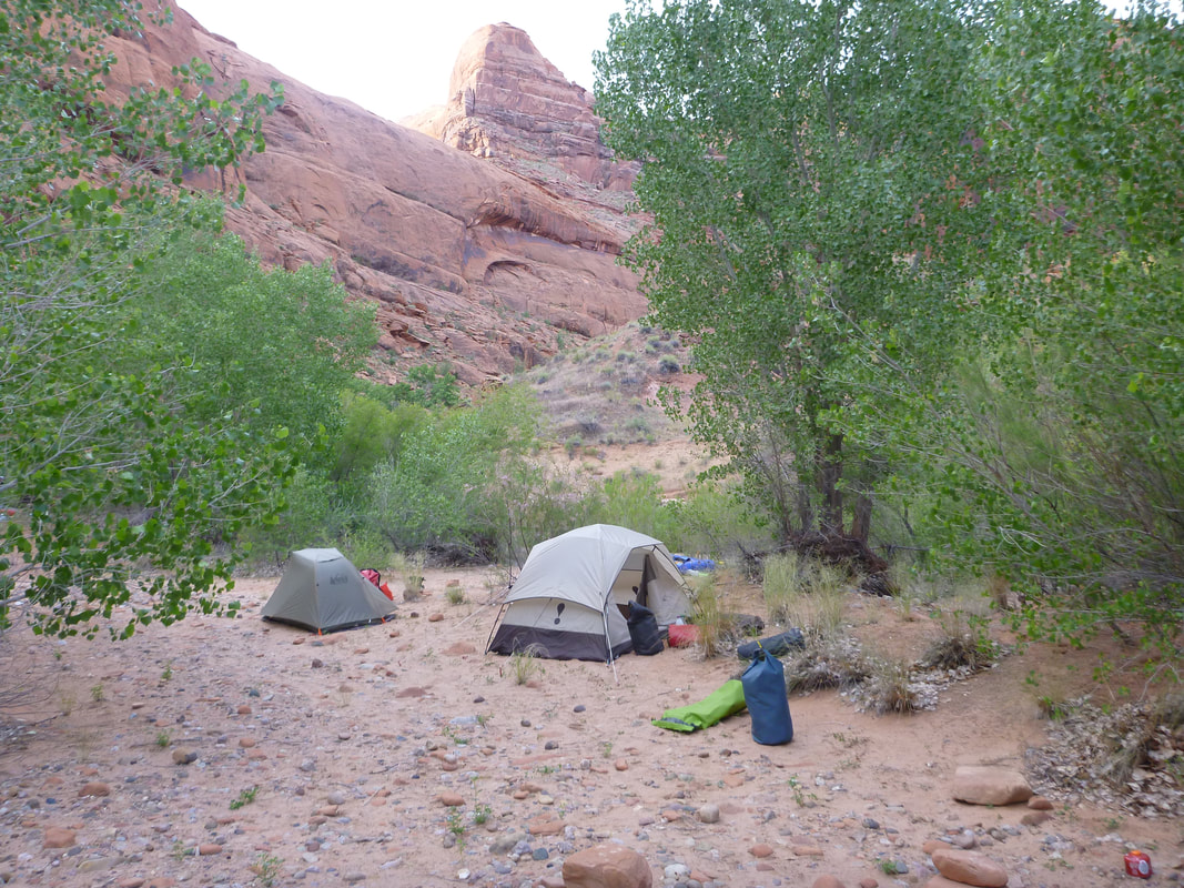
We started hiking following the cairns, but didn't realize that some of the cairns were for rock climbers and we had to follow the cairns for the trail to the river. On the map you have to stay to the left and go down the point. We got back on the right trail, but we were running out of time, so Debbie and Richard left their gear and headed back to the cars to drive the shuttle. Randy and I would come back for their stuff after taking the first load to the river. By the time Debbie and Richard returned, they were walking the trail in the dark. Fence Canyon was a nice place to camp.
Day 3:
We finally entered the river. We had 2 pack rafts and 2 duckies.
We finally entered the river. We had 2 pack rafts and 2 duckies.
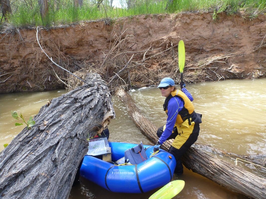
We had been warned about a tree in the river, but there wasn't much current, so we had no problem.
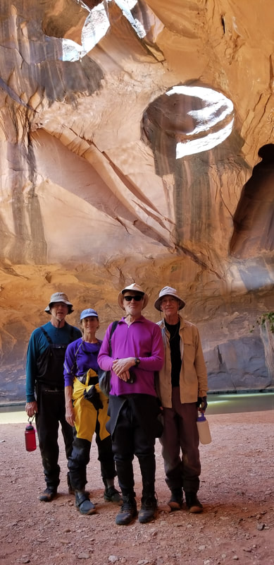
Next we hiked up Neon Canyon to see the Golden Cathedral. We were finally being tourists and enjoying the sights. There was a lot of poison ivy, so be careful on this hike. People were planning to rappel down from the three potholes. If you were an early explorer trying to get out of the Escalante Canyon, you would probably head up a side canyon. But the end of the canyon may be potholes 200 up.
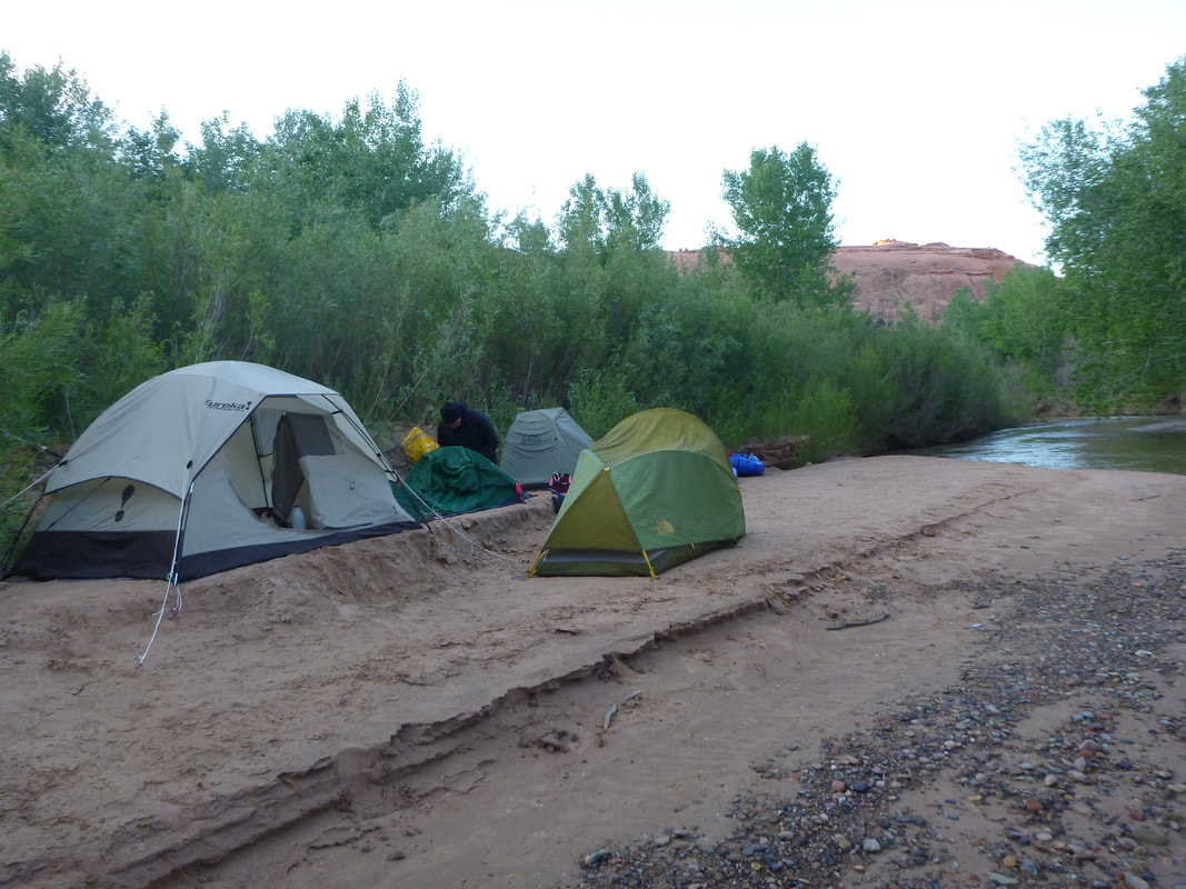
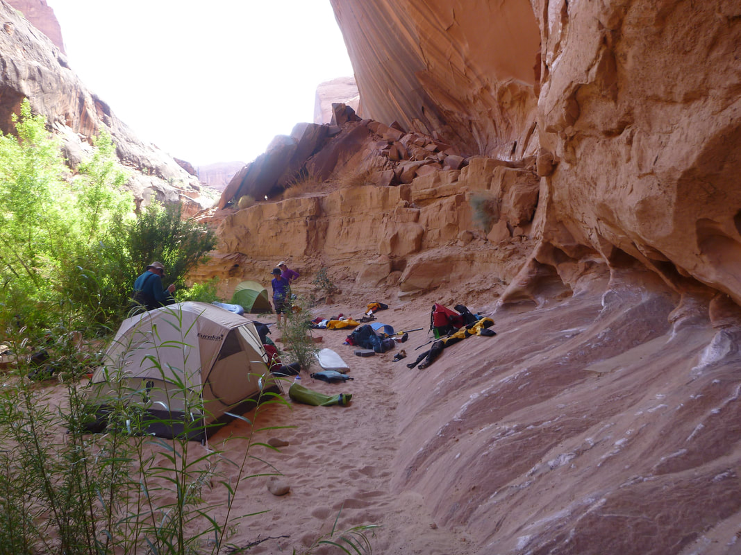
Our camp that night was on a small beach near 25 Mile Wash.
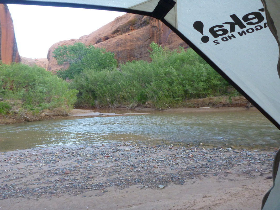
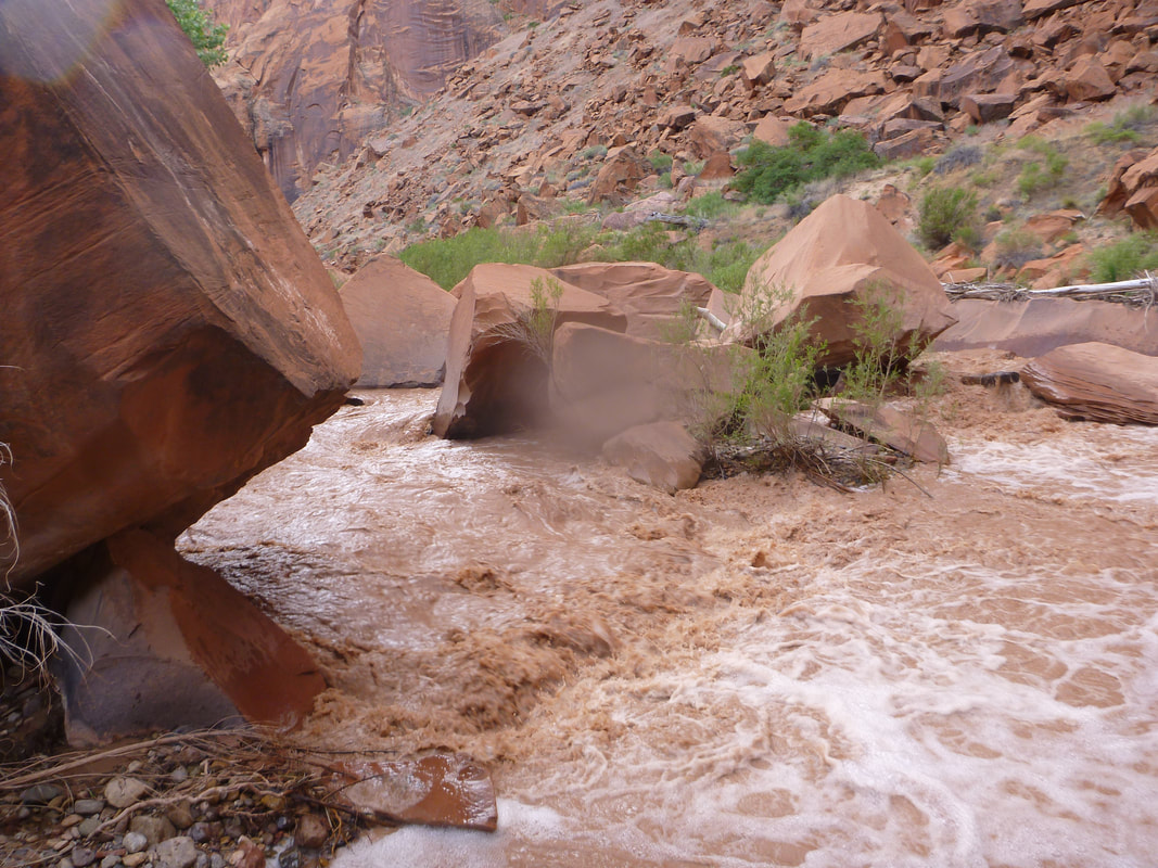
Day 4 was a cloudy day and it started raining after a while. Notice that the river is still pretty clear and pretty low, but it was enough water for our boats.
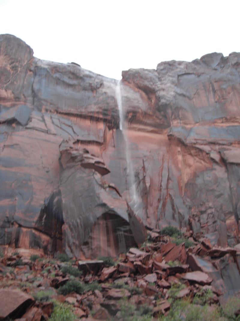
It continued to rain and there were waterfalls from the sides of the canyon.
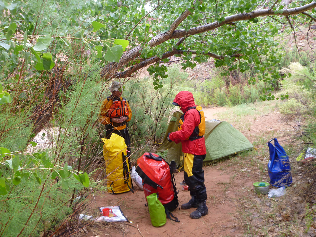
We finally decided to get off the river at Moody Creek as we were getting wet and cold.
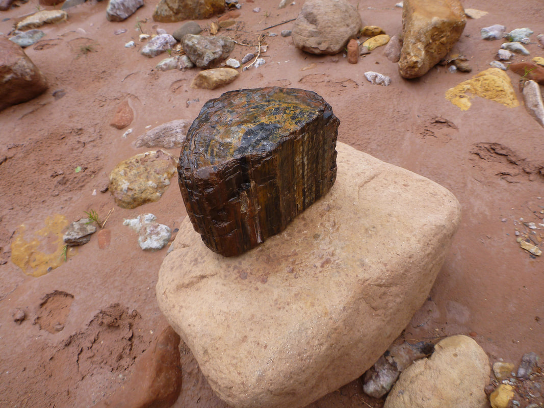
I had some time so I looked around for interesting rocks. This looked like a perfect example of a petrified log. It has the bark and rings and everything.
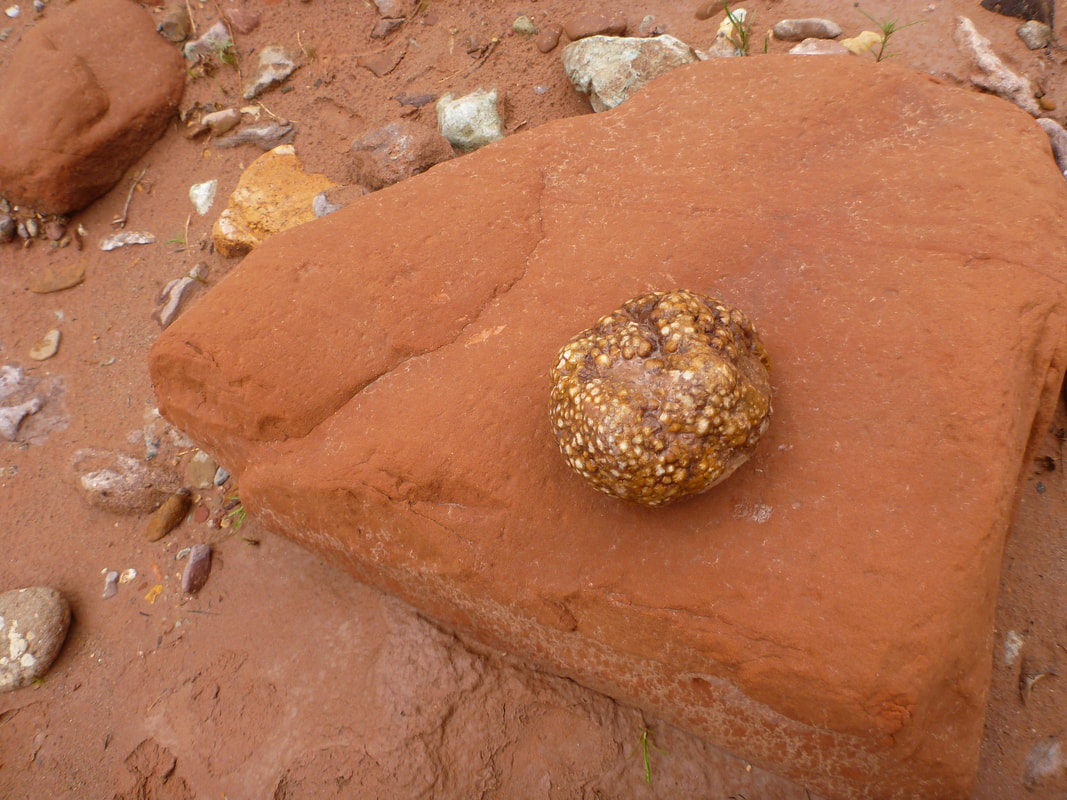
This rock was really strange. It look like petrified salmon eggs, or maybe petrified Boba tea.
Day 5:
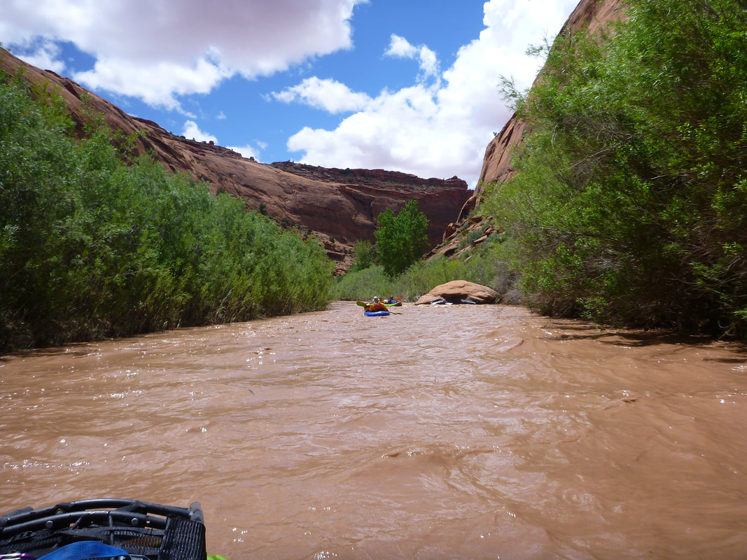
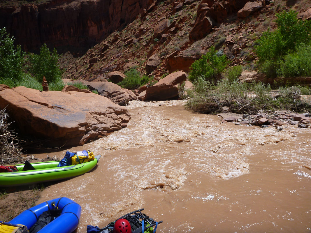
The next day was clear and sunny and the Escalante had a lot more water. We stopped at Scorpion Gulch and pumped some water. We were able to always pump from side streams and never had to pump the muddier Escalante.
The next day was clear and sunny and the Escalante had a lot more water. We stopped at Scorpion Gulch and pumped some water. We were able to always pump from side streams and never had to pump the muddier Escalante.
This is the "Boulder Jam Mandatory Scout/Probably Portage" rapid. We had been told to portage on river left, but I talked to some people on the bank and they said river right. I told the pack rafts to stay right and followed them through the rapid. One person swam and his pack raft took off down river. So we had 4 people and 3 small boats. We doubled up in one of the duckies and we found the pack raft. It was not damaged, but the Biil's Bag had been in the water a while. The one person who did the portage correctly on river left hit some rapids and also swam.
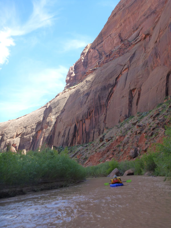
There were a lot of interesting rapids in this stretch of the river. Some involved a complete 90 degree turn of your boat. I think at this level it would be difficult to maneuver a tandem canoe down the Escalante. If the river were higher, it would probably be class III instead of II.
We thought it best to find a camp immediately to dry out the gear that got wet, so we camped across the river from George's Camp Canyon.
Breaking camp the morning of day 6. This is across from George's Camp Canyon.
We came to the second rapid marked on the map. This was a mandatory portage and well marked to portage on the left. It was like a rock strainer.
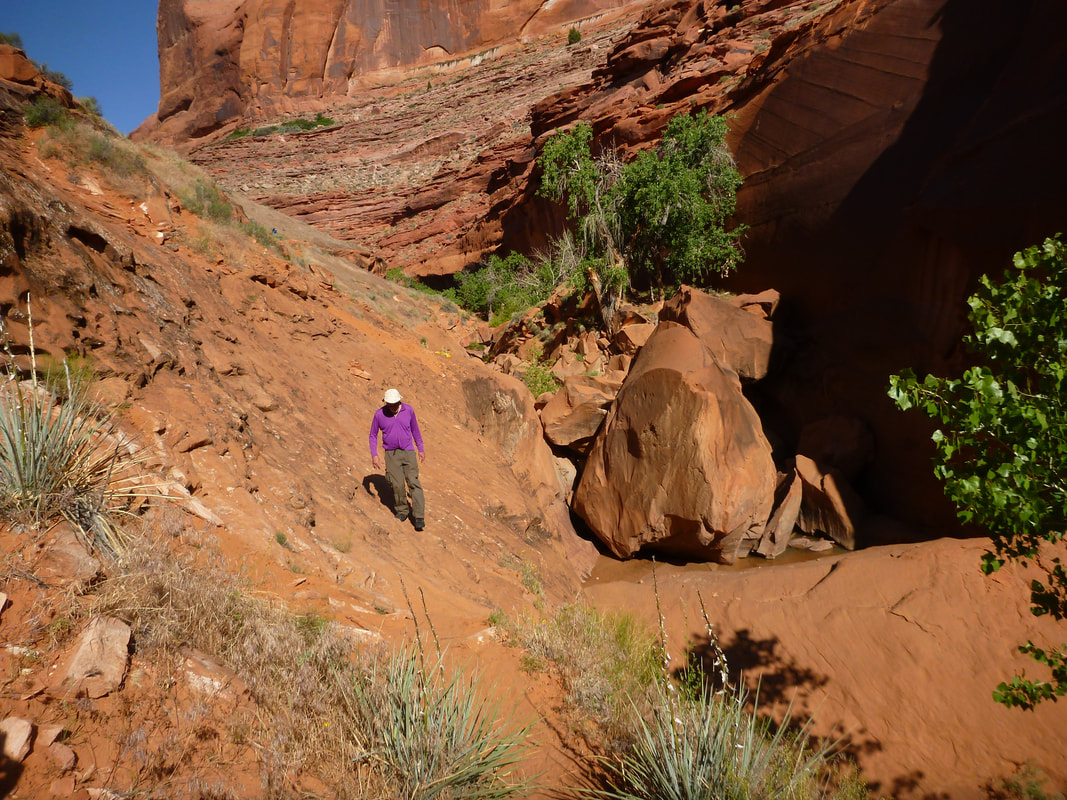
As we headed downstream the canyon was getting deeper.
The photo above is day 6's camp at Fool's Canyon.
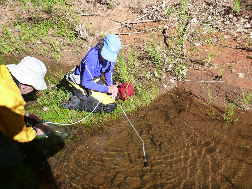
Filtering water from the creek in Fool's Canyon.
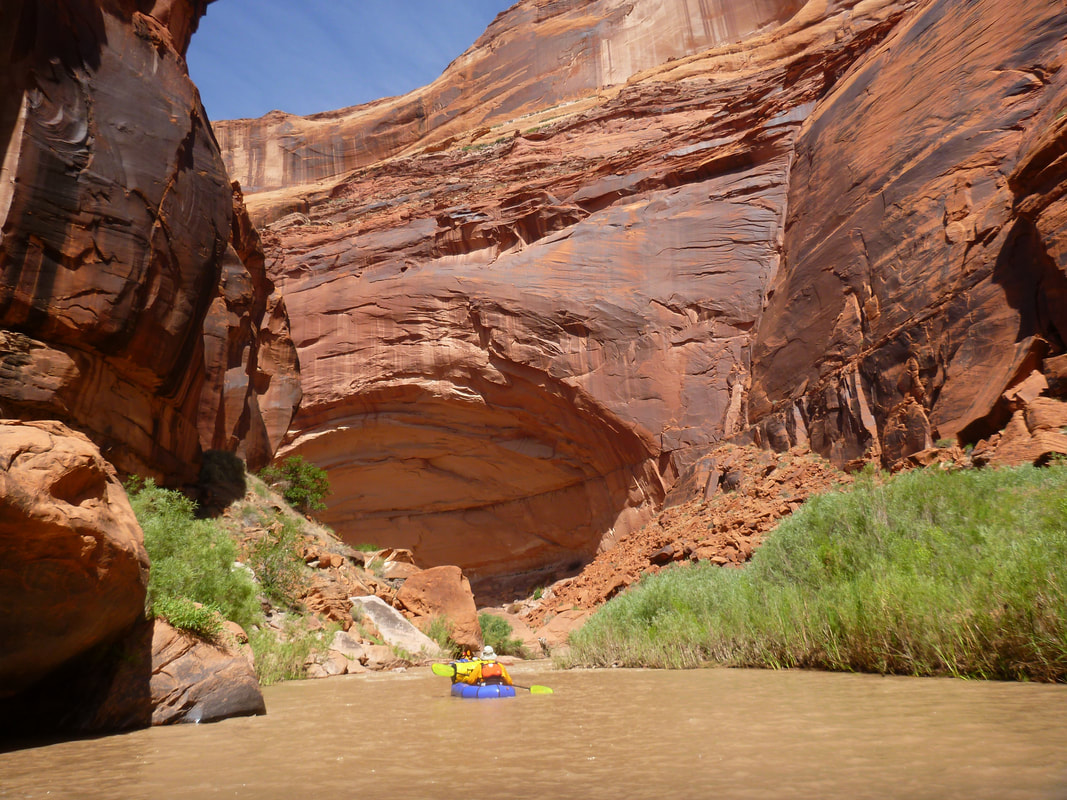
Great scenery!
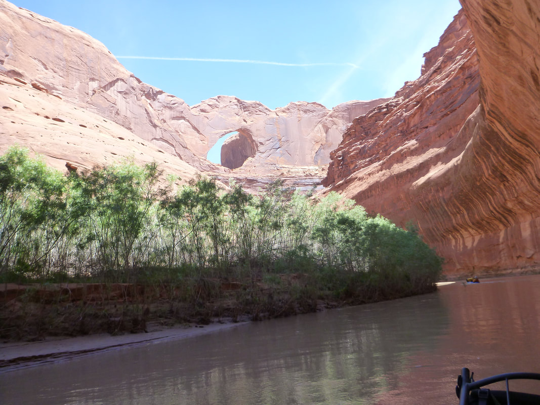
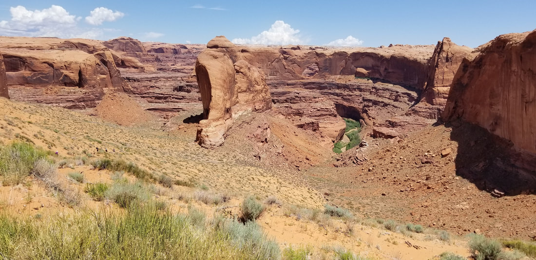
Steven's Arch, the trip is nearing the end as far as floating.
Day 7 camp in Coyote Gulch. There were weird and loud noises at night, probably frogs or toads.
Richard coming back to get more gear. We had to cross this really scary ledge. I have heard there is a better way, but we didn't know it at the time. It was a long way down to a rock bottom. Then we had to climb a big sand hill, rising 1000 feet.
One alternate route out of Coyote Gulch is described at this web page. It avoids the scary ledge, but you still have to hike up the sand hill. Alternate Route out of Coyote Gulch.
One alternate route out of Coyote Gulch is described at this web page. It avoids the scary ledge, but you still have to hike up the sand hill. Alternate Route out of Coyote Gulch.
View on the sand hill trail looking back at the river. We would move half our gear, drop it and go back for the other half. That way we didn't have to go all the way back. And we got a little rest each time we went downhill without a pack.
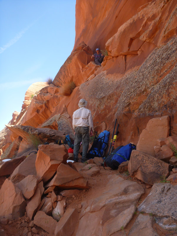
When we got to the crack-in-the-wall we hoisted our bags up. They wouldn't fit in the crack.
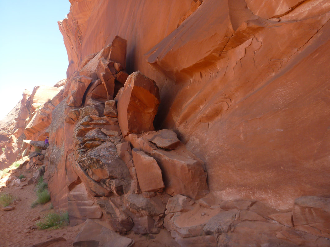
This is the entrance to the crack-in-the-wall. Just enter the crack on the right.
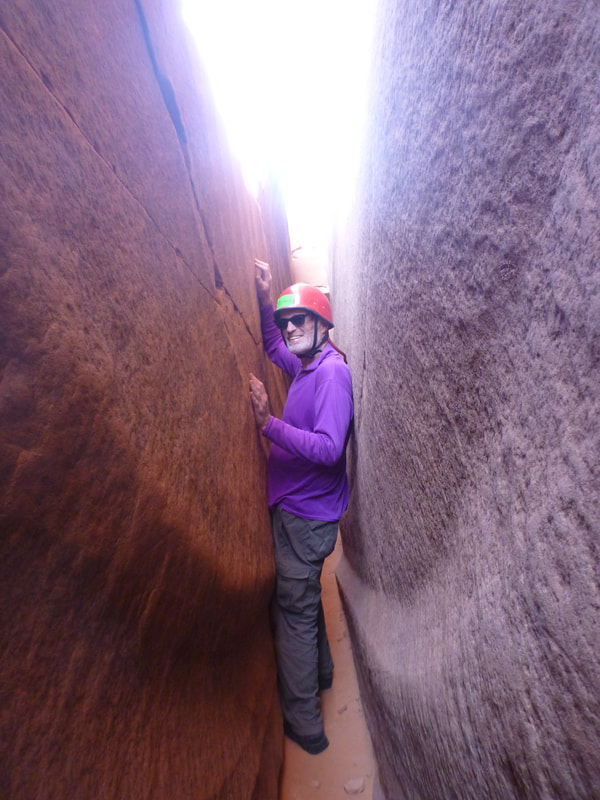
Going up the crack-in=-the-wall. Luckily the sand goes up, so you just walk to the next level and there is no fear of heights as you have rock on both sides.
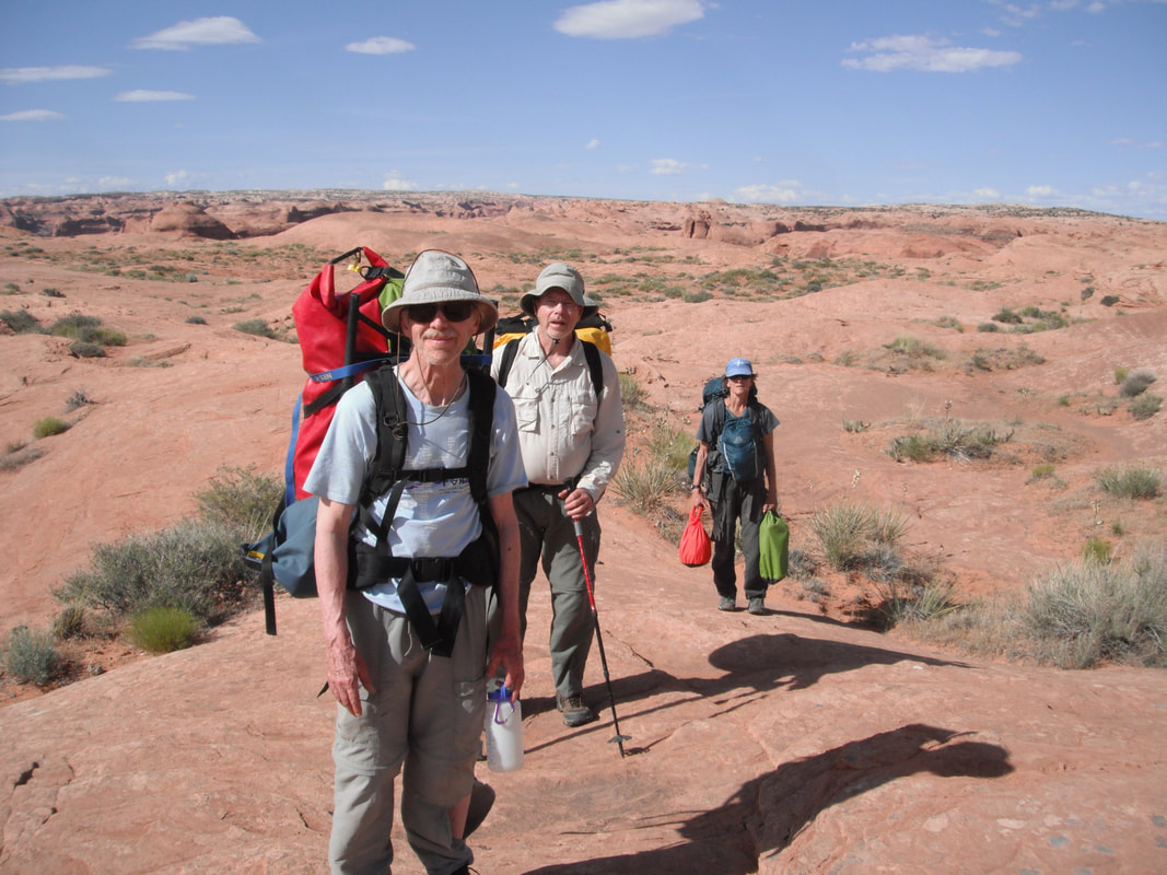
HIking out to the cars. We took half our gear, camped near the parking lot, and went back the next morning for the rest of our stuff.
Back in Escalante, we went out to eat. It was a great trip. I recommend it to everyone. It would have been easier if we didn't have to take two trips with all our gear. However, when we were on the river, it was nice to have a lot of stuff.
Written by Roger Faaborg, [email protected].
Written by Roger Faaborg, [email protected].