
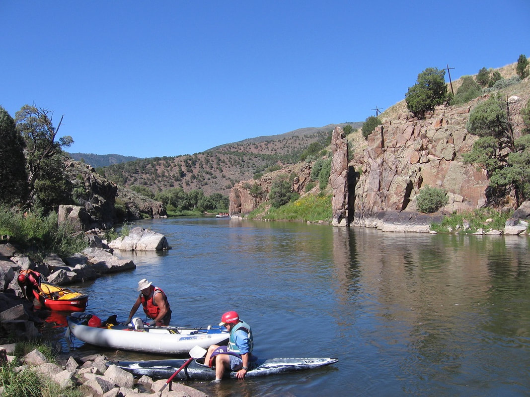
Pumphouse on the Colorado River
Stopping at the hot springs on the Pumphouse float
Rating: Class II/II+
When: Meet at the Pumphouse Campground boat ramp #3 at 8:30 am, Saturday, September 30, 2023.
Short Description courtesy of Steve Cassells, who hosted this float for many years: Join us on a nice cruise on a Class II/II+ trip through beautiful mountain scenery. Even the drive is pretty. There is enough whitewater to keep your attention and enough flat water to be able to enjoy the views and look for wildlife. A couple of pleasant surprises await first timers. Note that this year we are floating on Saturday. You may want to drive up Friday and camp at Pumphouse Campground. I have reserved Group Campsite A for Firday night and Saturday night, so you won't have to pay for camping, but there is a daily fee for each vehicle.
Directions to Pumphouse: Trough Road intersects highway 9 just south of Kremmling, Colorado. Go west on Trough Road. Trough Road is also labeled as County Road 1. Take Trough Road about 10 miles and take the turn off for the Pumphouse Campground. The put-in is at the #3 boat ramp, which is near the group campsite A. Driving from Fort Collins via I-70 takes about 3-3 1/2 hours depending on traffic.
Driving to the area: We are meeting at the Pumphouse boat launch #3 on Saturday at 8:30 am. That is early, so you would have to drive up very early on Saturday or may want to drive up Friday afternoon. To avoid the Denver traffic, you can follow the Poudre to Walden and then to Kremmling. It takes about 4 hours on this long route, but it is scenic. The reason we start so early is that the winds and storms can get bad up there. Steve Cassells floated it one year in a raft and it took 9 hours instead of the usual 5 because of strong winds. And we have to drive the shuttle in the morning which also takes some time.
Camping: I have Pumphouse Group Site A reserved for Friday evening and Saturday evening, the 29th and 30th. There is also camping at Radium Campground and a nice RV in Kremmling.
8:30 am Saturday:
Unload your boat at the put-in. Then drive the shuttle. Drive back to Trough Road and follow it south (right turn) . We can take-out at Yarmony Bridge or Rancho del Rio. Rancho del Rio has a $8 charge + $2 per person to leave a car there, but it is more secure than leaving our vehicles at Yarmony Bridge.
Distance:
The float is around 12-14 miles to Yarmony Bridge. It takes around 5 hours assuming a stop at the hot springs and a stop for lunch.
Rapids:
There are two named rapids. The "Eye of the Needle" comes first when you enter the canyon. Go to the right of the big rock that sticks up in the middle of the river. Then look ahead and dodge rocks and avoid walls. There is no good place to scout this rapid and scouting really isn't necessary. There are a few rocks and this continues about a 1/4 of a mile. At 1500 cfs, the waves are larger, but there are fewer rocks. The second rapid is the "Yarmony Rapid." It occurs after the Radium Bridge. We will scout the rapid by stopping in the eddy before it on river left. To run it, you enter on the tongue on the left and then work across to the right about mid-way down, then stay to the right of the big wave at the bottom. If you like big waves, you can just stay left at the bottom. The rapids are not too difficult, being Class II at 1000 cfs and class II+ at 1500 cfs.
List of Items along the River:
Host: Roger Faaborg, [email protected], 970 646 5706
When: Meet at the Pumphouse Campground boat ramp #3 at 8:30 am, Saturday, September 30, 2023.
Short Description courtesy of Steve Cassells, who hosted this float for many years: Join us on a nice cruise on a Class II/II+ trip through beautiful mountain scenery. Even the drive is pretty. There is enough whitewater to keep your attention and enough flat water to be able to enjoy the views and look for wildlife. A couple of pleasant surprises await first timers. Note that this year we are floating on Saturday. You may want to drive up Friday and camp at Pumphouse Campground. I have reserved Group Campsite A for Firday night and Saturday night, so you won't have to pay for camping, but there is a daily fee for each vehicle.
Directions to Pumphouse: Trough Road intersects highway 9 just south of Kremmling, Colorado. Go west on Trough Road. Trough Road is also labeled as County Road 1. Take Trough Road about 10 miles and take the turn off for the Pumphouse Campground. The put-in is at the #3 boat ramp, which is near the group campsite A. Driving from Fort Collins via I-70 takes about 3-3 1/2 hours depending on traffic.
Driving to the area: We are meeting at the Pumphouse boat launch #3 on Saturday at 8:30 am. That is early, so you would have to drive up very early on Saturday or may want to drive up Friday afternoon. To avoid the Denver traffic, you can follow the Poudre to Walden and then to Kremmling. It takes about 4 hours on this long route, but it is scenic. The reason we start so early is that the winds and storms can get bad up there. Steve Cassells floated it one year in a raft and it took 9 hours instead of the usual 5 because of strong winds. And we have to drive the shuttle in the morning which also takes some time.
Camping: I have Pumphouse Group Site A reserved for Friday evening and Saturday evening, the 29th and 30th. There is also camping at Radium Campground and a nice RV in Kremmling.
8:30 am Saturday:
Unload your boat at the put-in. Then drive the shuttle. Drive back to Trough Road and follow it south (right turn) . We can take-out at Yarmony Bridge or Rancho del Rio. Rancho del Rio has a $8 charge + $2 per person to leave a car there, but it is more secure than leaving our vehicles at Yarmony Bridge.
Distance:
The float is around 12-14 miles to Yarmony Bridge. It takes around 5 hours assuming a stop at the hot springs and a stop for lunch.
Rapids:
There are two named rapids. The "Eye of the Needle" comes first when you enter the canyon. Go to the right of the big rock that sticks up in the middle of the river. Then look ahead and dodge rocks and avoid walls. There is no good place to scout this rapid and scouting really isn't necessary. There are a few rocks and this continues about a 1/4 of a mile. At 1500 cfs, the waves are larger, but there are fewer rocks. The second rapid is the "Yarmony Rapid." It occurs after the Radium Bridge. We will scout the rapid by stopping in the eddy before it on river left. To run it, you enter on the tongue on the left and then work across to the right about mid-way down, then stay to the right of the big wave at the bottom. If you like big waves, you can just stay left at the bottom. The rapids are not too difficult, being Class II at 1000 cfs and class II+ at 1500 cfs.
List of Items along the River:
- Start at Pumphouse Campground, Boat Launch #3
- Eye of the Needle rapids about 1 mile from the put-in
- Hot Springs and Cabin. They are about a mile after the Eye. Following the Eye is another series of mild rapids, ending with a hard left turn (avoid the wall on the right), and just below that is the old log cabin on the left. Then another short rock garden with a tricky pour-over in the middle of the rapid at the bottom. Then it mellows out, and the springs are on the left in a narrow spot with vertical wall just above it. I've never seen it totally unoccupied (would be nice). Across from the hot springs is a cliff that you can climb and jump into the river, if you are so inclined.
- Lunch. Take a sack lunch along with all the other items you need to be on the river for several hours. We will stop along the way to eat lunch. We can stop at the Radium campground or several other sites. picnic ground site with outhouse on the right is about a mile below the hot springs. There are about 4 picnic spots along there (all on left), if not occupied. Then the Radium campground is on the left after the Radium bridge. No other formal picnic spots exist until below Yarmony Rapids - and there are about 4 or 5 over the next mile below that rapid.
- Bridge at Radium
- Radium Campground
- Yarmony Rapids
- Dinosaur Tracks near Rancho Del Rio, on river right, across from a really large picnic table, which is on river left.
- Yarmony Bridge take-out
- You will need a sack lunch to take on the Pumphouse run.
Host: Roger Faaborg, [email protected], 970 646 5706
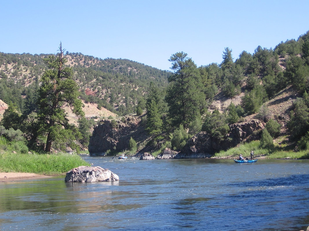
The Colorado River on the Pumphouse float