North Platte River Near Saratoga, Wyoming
Dates:
11:00 am Saturday, July 13, 2024, meet at Treasure Island. We float from Treasure Island to the Hobo Hot Springs in Saratoga.
11:00 am Sunday, June 14, 2024, meet at the Hobo Hot Springs boat ramp. We float from the Hot Springs to Pick Bridge.
You are welcome to float either day or both. Both Poudre Paddlers and RMCC are invited. This is not an ACA activity.
Rating: Class I float for flows below 2000 cfs and class I+ for flows over 2000 cfs. The North Platte is not dam controlled, so it is best to check the gauge before you drive.
Flow: Link to North Platte flow near Sinclair, downstream from Saratoga.
North Platte Gauge near Sinclair
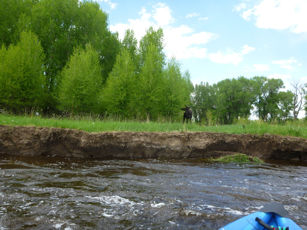
Note: You should be able to control your boat to avoid trees that fall in from the bank, or accumulate at the upstream side of islands. You should have some prior experience floating in moving water. All the gear in your boat should be tied down and you should be prepared to get wet. Anytime you go on the water, you should be prepared to get wet. Wear quick-drying clothes, or take a change of clothing in a dry bag. At around 500 cfs and less, it is a fun, lazy river.
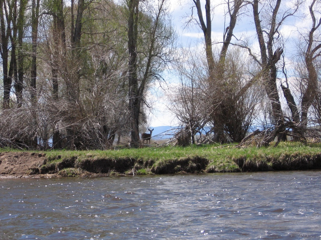
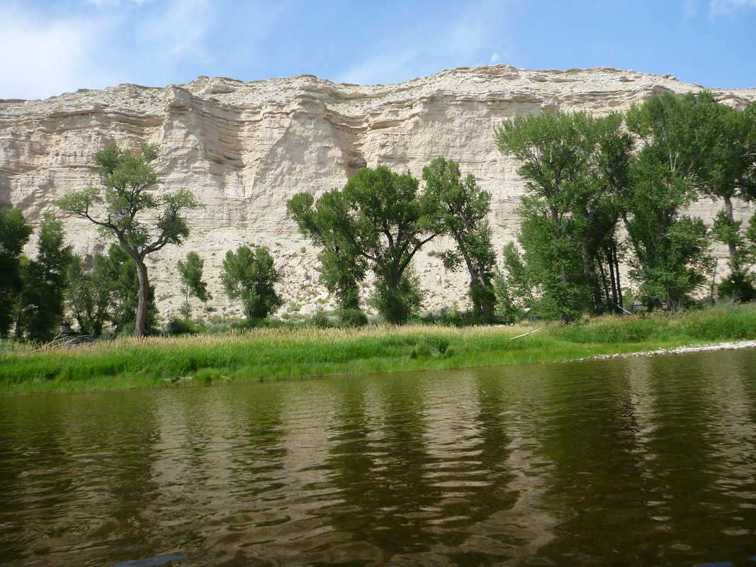
Overview: The North Platte River starts in Colorado and flows north between the Snowy Range on the east and the Sierra Madre Mountains on the west. It is lined with cottonwoods and large bluffs. The wildlife includes deer, antelope, Great Blue Herons, pelicans, Canada Geese and Bald Eagles. It is a 12 mile float from Treasure Island to Saratoga where we stop at the Hobo Hot Springs. It is 10.8 miles from the Hot Springs to Pick Bridge.
Wyoming Decal: If you are floating a boat in Wyoming, you need to purchase an invasive species decal. Only inflatables of 10 feet or less are exempt. You can purchase the decal for $15.00 at this link or at any store in Wyoming that sells fishing licenses.
Link to purchase a Wyoming Decal.
If you order online, you need to have a printer so you can print a receipt that is good for 15 days. They will mail you the actual decal within 10 days. We were checked on the North Platte river once. You need a separate sticker for each boat you float in Wyoming. The money goes to trying to keep invasive species out of Wyoming.
Wyoming Inspection: All boats have to stop and be inspected as they enter the state during the summer months. That includes canoes and kayaks. The inspection stations are only open certain hours, so you will have to plan your trips accordingly. This will affect all floats on the North Platte. If you plan on driving up 287 to Laramie, then the inspection station is at the Port of Entry, 1 mile south of Laramie.
Link to information on Wyoming Inspection Stations.
Maps:
Upper North Platte River Map ( I like this one)
2022_upper_north_platte_river_float_map_final_3-way-front-fold.pdf2022 Upper North Platte River Map
Upper North Platte River Map ( I like this one)
2022_upper_north_platte_river_float_map_final_3-way-front-fold.pdf2022 Upper North Platte River Map
Driving to Saratoga:
A. South Route
The drive from Northern Colorado to Saratoga takes about 3 hours. Take 287 to Laramie. Stop at the Port of Entry 1 mile south of Laramie to get your boat inspected. Go west on I-80 and immediately exit on Wyoming Highway 130 Snowy Range Road. Then go south on Highway 230 from Laramie, which goes back to Colorado and becomes Highway 127. When 127 and 125 cross, take 125 north towards Saratoga. As you leave Colorado, 125 turns back into 230. Follow 230 North where it joins with 130 and enters Saratoga. This route has nice scenery, but not as good as the Middle Route.
B. Middle Route
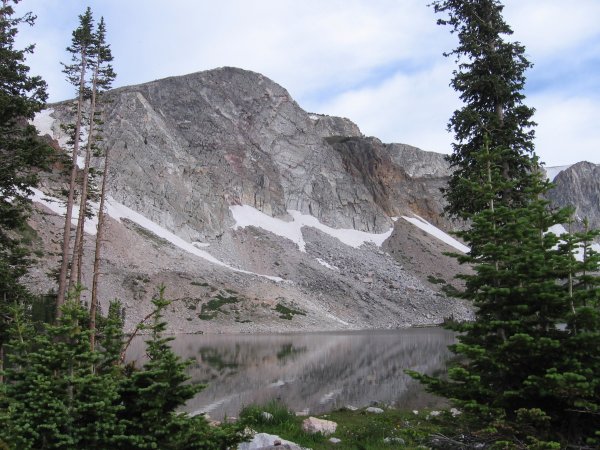
The snowy range road (130) is closed in the winter, so make sure it is open before going on this route. Take 130 and stop at Lake Marie. Lake Marie is a beautiful lake. See photo below. This route has the best scenery. It is like Trail Ridge Road, but not as high.
North Route:
The third route is to stay on I-80 and go south on 230 into Saratoga. The I-80 route has a lot of big trucks, but you do see a lot of windmills and it is the fastest route.
Places to stay near Saratoga:
The third route is to stay on I-80 and go south on 230 into Saratoga. The I-80 route has a lot of big trucks, but you do see a lot of windmills and it is the fastest route.
Places to stay near Saratoga:
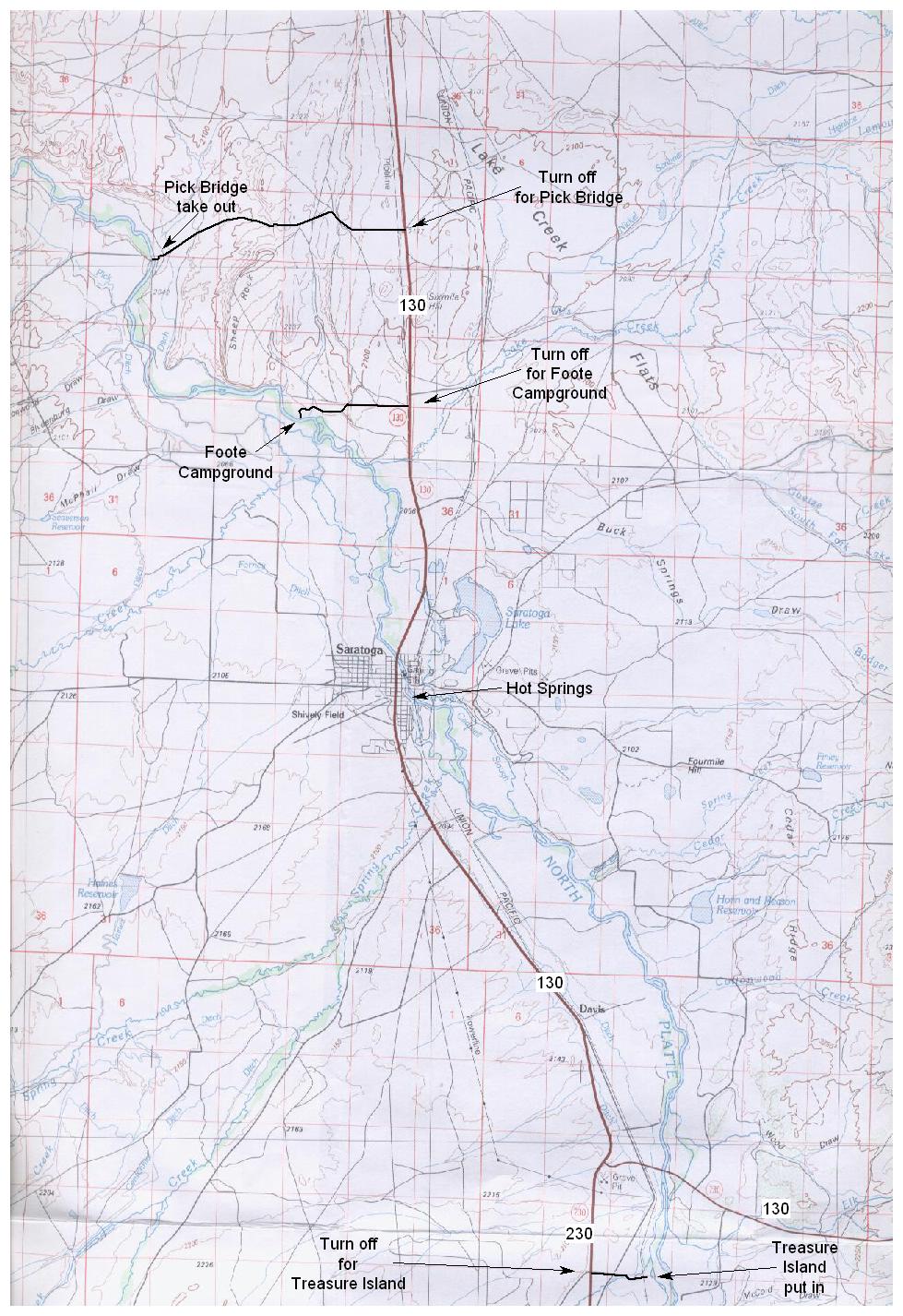
- Pick Bridge has free camping and it is a nice campground. Camp on the west side of the river. It has an outhouse and no running water. To reach Pick Bridge Campground follow Highway 130 North out of Saratoga and turn left after about 9 miles.
- Foote Campground has free camping. It is a nice campground along the river with trees. It has an outhouse and no running water. To reach Foote Campground follow Highway 130 North out of Saratoga and turn left after about 4 miles. There is also a boat ramp at Foote, so make sure you are camping at the campground and not the boat ramp. The campground is to the north of the boat ramp.
- You can camp at Saratoga Lake, but there is a fee. It has more modern facilities, but not too many trees. In the low areas, there may be mosquitoes.
- Treasure Island has free camping. It is in a low area and has a lot of trees. The mosquitoes are often bad.
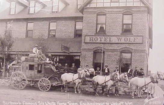
- The historic Hotel Wolf is in downtown Saratoga. 101 E. Bridge Street 307-326-5525. Diana and I have stayed there. It is a nice old hotel with a restaurant and bar. There are other motels in town. Eric recommends the Riviera.
Saturday Itinerary
11:00 am, Saturday: Meet at Treasure Island. It is about 8 miles south of Saratoga. There is a sign on highway 230. It is also about 1.5 miles south of the intersection of 230 and 130. The road into the river is only about a mile.
Unload equipment. Make sure you have, as a minimum: canoe/kayak, paddles, PFDs, water, hat, rain gear, jacket, sunscreen, sun glasses, bug repellent, sack lunch, and a small first aid kit. If you are going to wear cotton, then you should bring a dry bag with a change of clothes. On any float trip there is the possibility of getting very wet. Bring a sack lunch. We will stop on Treasure island to eat lunch.
12:00 noon: Some paddlers will stay with the equipment while one person per car drives the shuttle. Put your car keys in a safe place, like inside a zippered pocket on your life jacket. It is advantageous to take two keys. The people staying with the equipment should take turns checking out Treasure Island. There is a swinging bridge out to the island. The drivers will head north on 230 and go to the boat launch near the Hot Springs in Saratoga. One or two cars will take the drivers back to Treasure Island.
1:00 pm: Go over safety rules. The river flows through private and public property. Property boundaries are marked along the river by red and blue squares. Property behind a red square is private and behind a blue square is public. From Treasure Island north, the land is entirely private.
1:30 pm: Finally, Hit the water! We will paddle a short distance and stop for lunch on Treasure Island. The float may take from 3 to 5 hours, depending on the flow. As we get close to town, you have to stay left. There are a lot of channels and you don't want to float past the town.
4:00-6:00 pm: We takeout at the Hot Springs. You are welcome to soak in the hot springs and then enjoy a nice meal in Saratoga.
Sunday Itinerary
11:00 am, Sunday: Meet at the boat ramp near the Hot Springs.
Unload equipment. Make sure you have, as a minimum: canoe/kayak, paddles, PFDs, water, hat, rain gear, jacket, sunscreen, sun glasses, bug repellent, sack lunch, and a small first aid kit. If you are going to wear cotton, then you should bring a dry bag with a change of clothes. On any float trip there is the possibility of getting very wet. Bring a sack lunch. We will stop almost immediately on the river to eat lunch on Veterans Island.
12:00 noon: Some paddlers will stay with the equipment while one person per car drives the shuttle. Put your car keys in a safe place, like inside a zippered pocket on your life jacket. It is advantageous to take two keys. The drivers will head north on 230 about 9 miles and turn west on a gravel road which goes to the Pick Bridge. There is a sign on the road that says something about Pick Bridge river access. The gravel road is about 2 miles long and you go to the boat ramp, not the campground. One or two cars will take the drivers back to Saratoga.
1:00 pm: Go over safety rules. The river flows through private and public property. Property boundaries are marked along the river by red and blue squares. Property behind a red square is private and behind a blue square is public. From Saratoga north, the land is almost entirely private.
1:30 pm: Finally, Hit the water! We will paddle over to Veterans Island and eat our sack lunches. The float may take from 2 to 4 hours, depending on the flow. There is a side channel that we used to take, but once it had an electric fence across it, so it is not advisable to take any side channels. We will stop at Foote Campground to stretch our legs and drink water.
3:30-5:30 pm: The take-out is on river right just before Pick Bridge. It is hard to miss a bridge.
If you have questions, contact Roger Faaborg. [email protected], Cell phone: 970-646-5706. In case the weather forecast is terrible or the water is too high, we will pick a another date. Make sure you notify me if you are interested so I can contact you about any changes to the trip.
Some Phone Numbers:
- North Platte Valley Medical Center, 1300 West Bridge Avenue, (307) 326-3169
- Saratoga Police, 11o E. Spring Avenue, (307) 326-8316
- Saratoga Towing, 305 N. State Street, (307) 326-5700

