
North Platte River
Six Mile Campground to Prospect
Day Trip
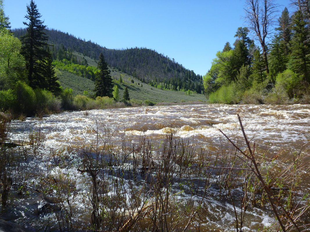
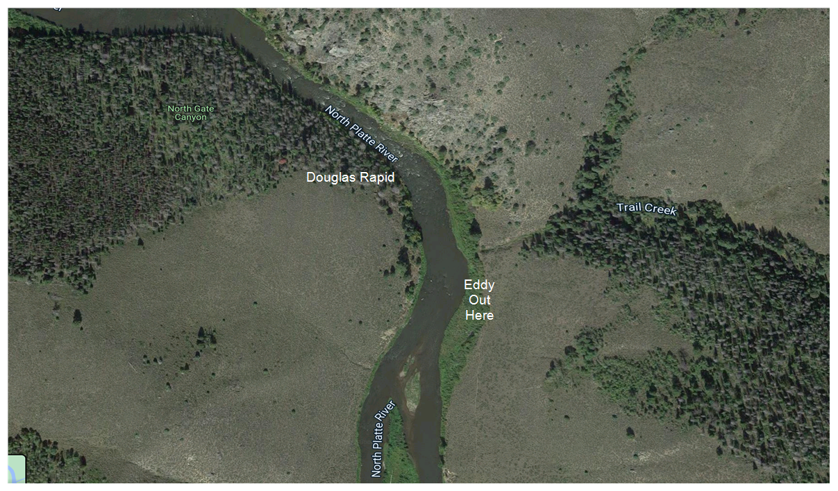
Top of Douglas Rapids. You can see where we pull up our boats to scout. Picture taken from river right.
General Information: This describes a day trip floating the North Platte from Six Mile Campground to the Prospect take-out. It is a beautiful float through the Platte River Wilderness. This is a day trip, so no camping gear is needed. It is important to travel light, as we carry our boats for 1.5 miles and up 800 feet at the take-out. This is an idea float for pack rafts or light duckies.
Class: Class II with one Class III, Douglas Rapids. Douglas can be scouted and portaged on river right.
AIS Sticker: You have to purchase an invasive species sticker for your inflatable boat if it is 10 feet or over in length. You can do this online and get a temporary sticker if you are in a hurry.
https://wgfd.wyo.gov/Fishing-and-Boating/Aquatic-Invasive-Species-Prevention/AIS-Decal
Inspection: All boats, regardless of length, have to be inspected upon entering Wyoming. There is a station about 1 mile south of Laramie on 287 at the port of entry. It opens at 6:00 am.
https://wgfd.wyo.gov/Fishing-and-Boating/Aquatic-Invasive-Species-Prevention/AIS-Inspection-Locations
Weather: The float is around 8000 ft elevation, so it is usually cooler there than in Northern Colorado.
Itinerary:
Last Trip: Saturday, June 4th, 2022
1. Drive to Six Mile Campground: 1. To get directions from your house to Six Mile Campground, go to Google Maps and search for "Six Mile Campground, WY". Basically you drive to Laramie on 287 and get your boat inspected at the port of entry. It opens at 6:00 am. Then get on I-80 West and immediately exit onto 230 West. Follow 230 West and it goes back into Colorado for a while and then take 125 North back into Wyoming. Allow about 2.5 hours to get there from Fort Collins.
2. 10:00 am Saturday: Meet at the parking lot behind Six Mile Campground. You drive through the campground to get to the trailhead.
You can inflate your boats either at the top of the trail or carry them down to the river and then inflate them.
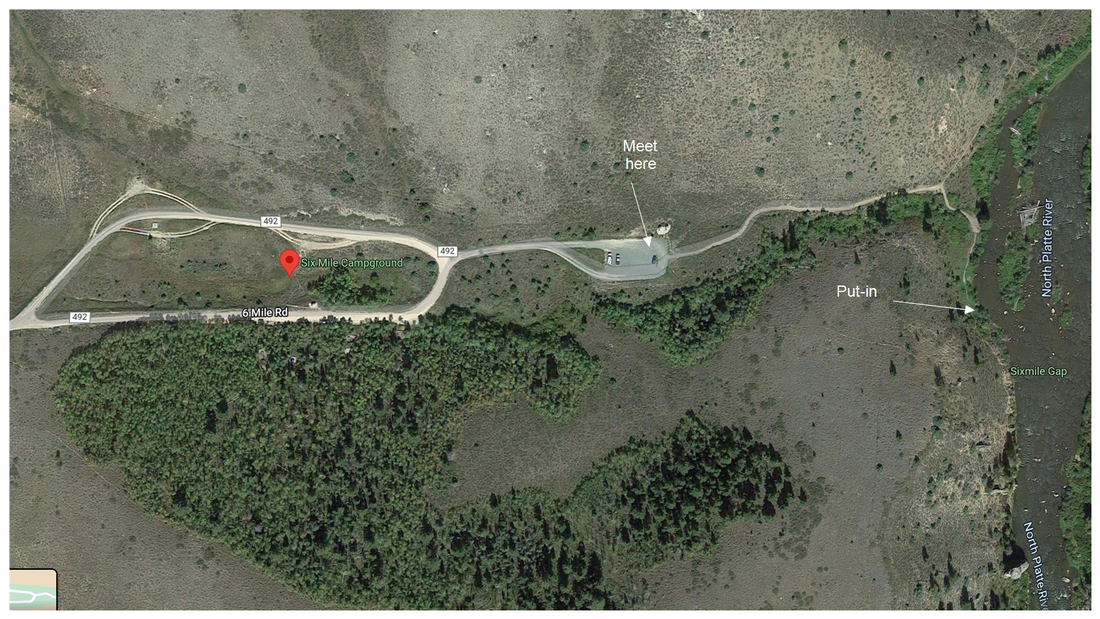
Six Mile Campground
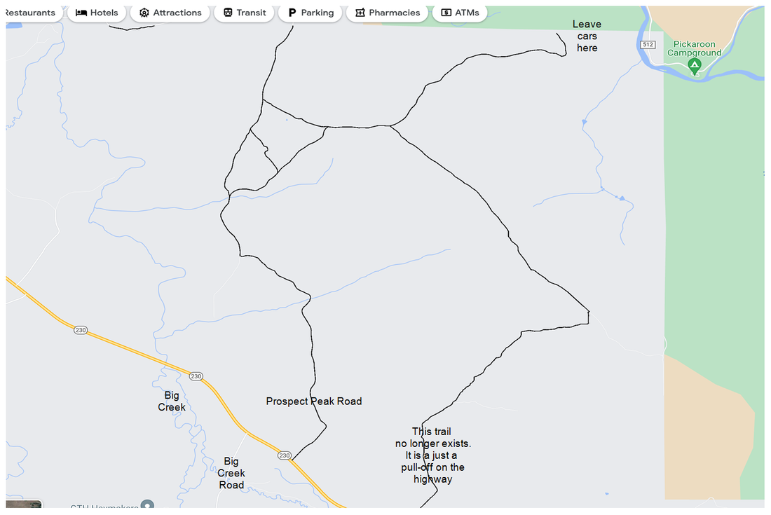
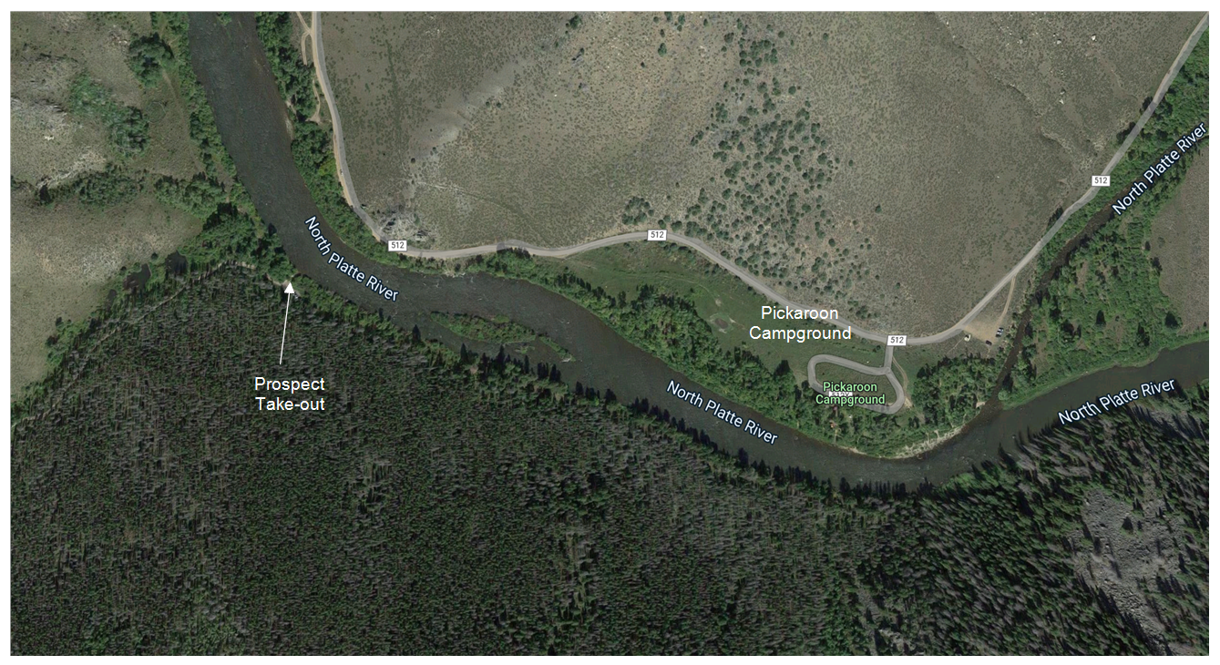
3. About 11:00 am Saturday: Drive to the top of the take-out. See picture below. To get there, drive back to Highway 230 and go North for about 3.5 miles. Go East on the Prospect Peak Road. It is the first road that you come to going East. There is a turn off that use to be a road, but Prospect Peak Road is the next road going East. There should be a brown sign. Follow Prospect Peak Road for about 6 miles to where you leave the cars. Leave some cars and drive back to Six Mile. You can either start the float or each lunch first and then start the float.
If you are coming from Six Mile and get to Big Creek, you need to go back to Prospect Peak Road.
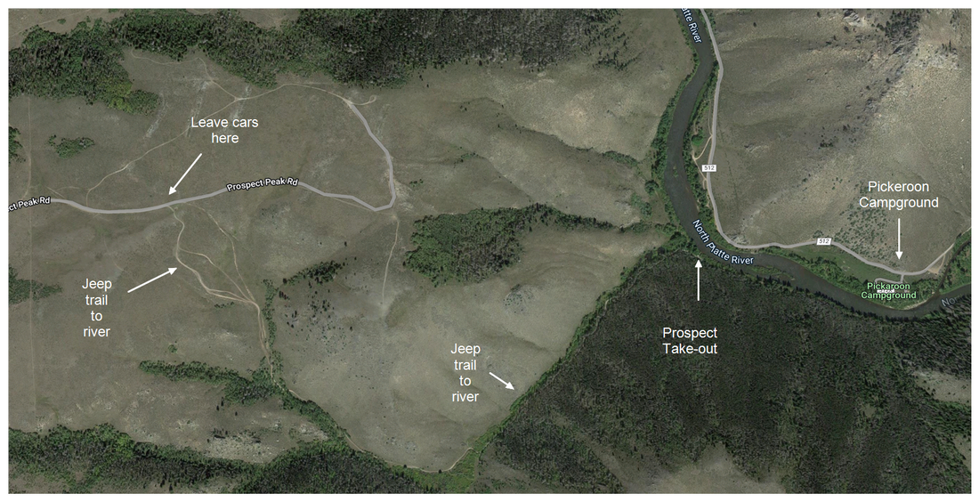
Take-out at Prospect
You leave your cars at the top near where the Jeep trails starts. The last time I drove the Jeep trail, I said," never again." Note that Pickeroon Campground comes first and then start looking for Prospect on river left. Don't miss it, as it is 17 miles to Bennett Peak the next take-out.
You leave your cars at the top near where the Jeep trails starts. The last time I drove the Jeep trail, I said," never again." Note that Pickeroon Campground comes first and then start looking for Prospect on river left. Don't miss it, as it is 17 miles to Bennett Peak the next take-out.
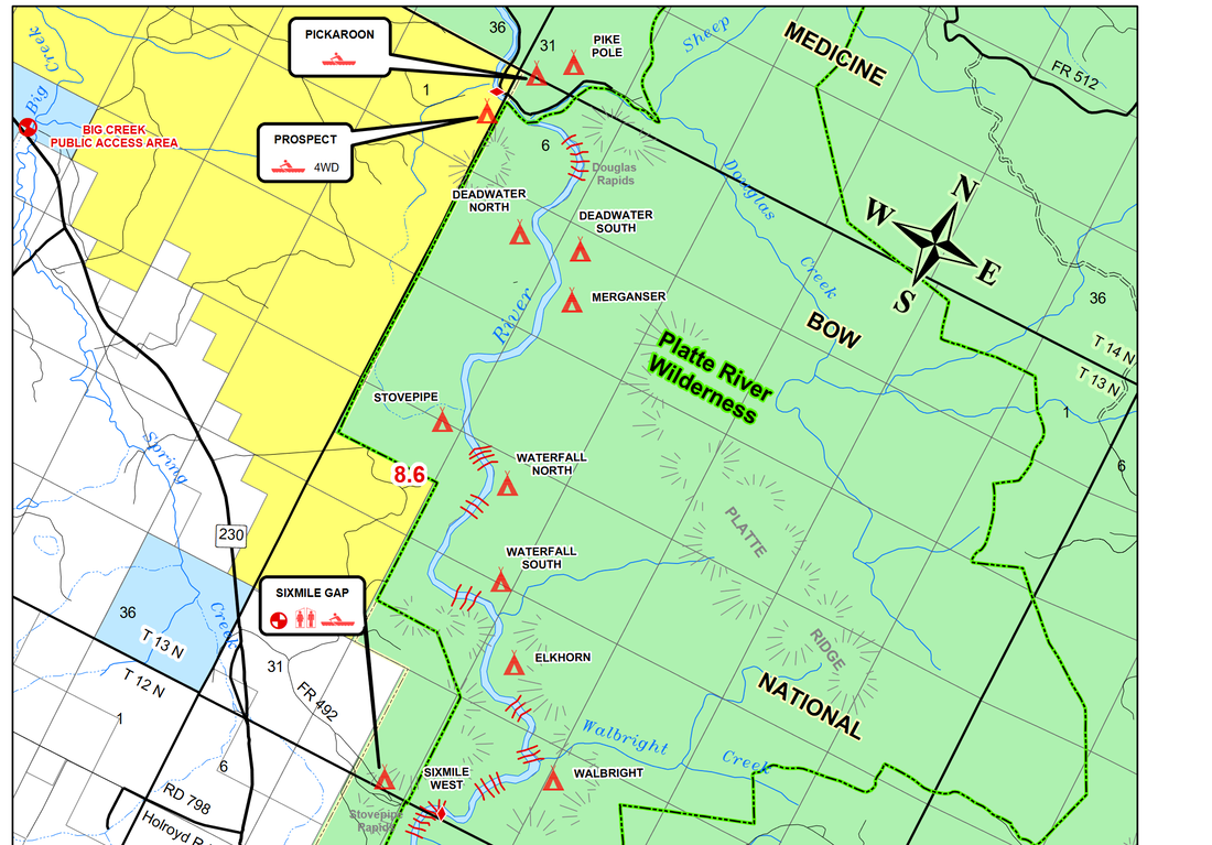
The Float: At the put-in you may want to paddle up stream and enter the main flow at the top of the island that is in front of you. Eddy out after the first right bend and form up again. The float is about 9 miles from Six Mile Campground to Prospect.
Basically this is a read and run stretch. There are small rapids interspersed by flat areas. The campgrounds used to be marked with 4X4 posts, but an ice dam destroyed most of them. There is a small waterfall on river right at Waterfall South or North, I can't remember which. This is all public land so you can stop and stretch your legs anywhere.
Douglas Rapid: You should scout Douglas Rapids. Scouting a rapid adds to the suspense and makes you drink more water. There aren't many islands, but there are some above Douglas. Because it is a drop, the water is calmer at the top and you can paddle over to river right above the rapids and pull your boat up on shore, or tie it to a willow. You scout from river right and there is a trail. See the picture below.
Take-out: After Douglas Rapid, start looking for Pickeroon Campground on river right. After Pickeroon, immediately watch for Prospect on river left. There may be an island in the way. Prospect is basically a parking lot, near the water, so you may see some cars or trucks. Next you roll up your boat and begin the long hike up the mountain. Take your time. You are at about 8000 feet elevation.
Readings for GPS
Six Mile Put-in:
41.044285402719645, -106.39439744162458
Deadwater South - Nice Campground
41.1105405900856, -106.4142326582025
Right Before Douglas Rapid
41.12178668159644, -106.41924778295662
Pickeroon Campground
41.126006660916694, -106.4290670690528
Prospect Take-out
41.1270385152983, -106.43671662517175
Safety Talk
1. Entrapment. Don’t stand up in moving water. Swim near the surface where it is save.
2. Swim on your back with butt up and feet downstream.
3. Are you OK? I’m OK. Tap helmet signals
4. PDF on and secure
5. Whistle (someone is swimming, try to help)
6. Paddle signals (stop, left,right,all clear, wave for help)
7. Lead and Sweep boats